MTP-5 + WIND PROFILE = Control and monitoring of the temperature inversion periods potentially dangerous according MTP-5 data. 3.1.5. ...In these circumstances the shear below the jet can be significant and is proportional to the strength of the inversion. The level of maximum wind is generally below 500 m (1 600 ft) and therefore of considerable interest to aviation. (Doc 9817 AN/449, Manual on Low-level Wind Shear, International Civil Aviation Organization, First Edition — 2005)
MTP-5 + solar radiation + wind gradient = Measurement of turbulence and height of the mixing layer by using MTP-5 Icing (heights hazardous for icing)
While the icing can occur over a wide range of negative temperatures, the probability is maximum in a relatively narrow range of temperatures and relative humidity (from -5 to -10°C and > 85% respectively). Outside these intervals icing probability decreases rapidly. Results of the test of aircraft possible icing predicting areas method (read in russian)
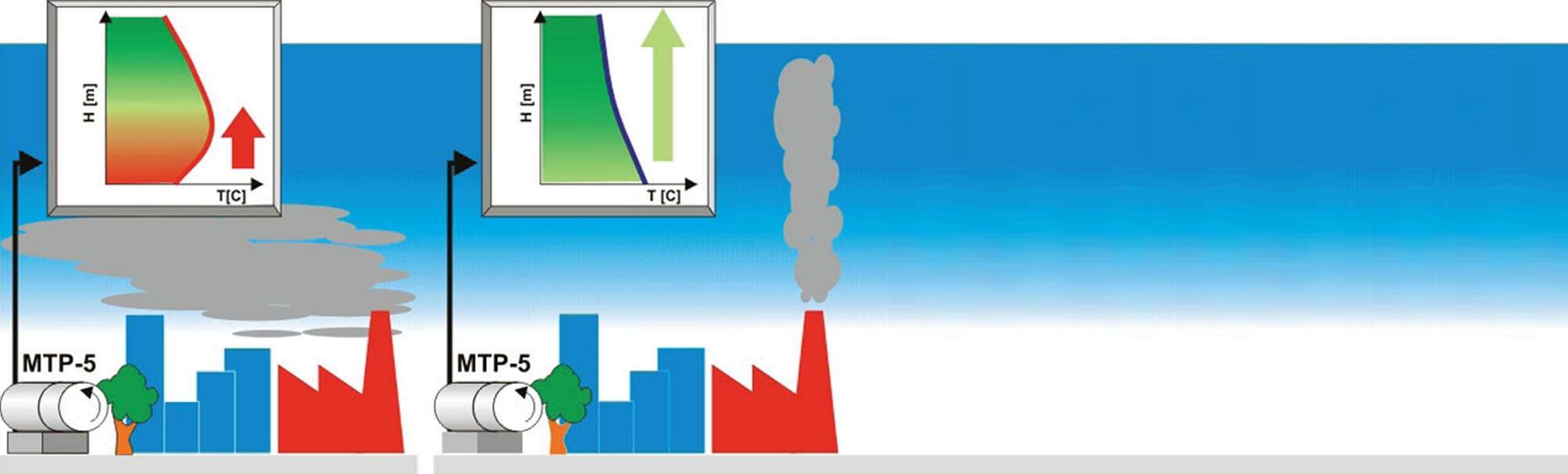
MTP-5 + weather forecast + meteorological data = The temperature profile determines the vertical transport of air masses and the condensation of the water vapor of the atmosphere. Monitoring by using the MTP-5 data provides a warning about the development and the scattering of fog.

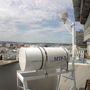
The vertical profilers are tools to measure remotely in some meteorological troposphere layer closest to the earth called PBL - such as temperature, wind and humidity, up to over 1,000 m vertically above the point of measurement. L 'ARPAV-Meteorological Centre of Teolo (CMT), within the project SPD and the project "Air pollution in the City of Padua", acquired and installed 8 vertical profilers in its network of stations for measuring ground meteorological variables . Previously the CMT, as other centers Meteorological, used for the analysis and forecasting of weather conditions in Veneto vertical profiles detected by soundings SATIN, measurements taken with instruments hanging from a balloon filled with helium and made every 12.6 hours at the airports. In Veneto not making soundings, the closest are those of Milan, Bologna and Udine; the intersection of the data appeared, therefore, rough, uneven and poorly valid.
The profilers, instead, allow to study the vertical structure of the atmosphere in a continuous and detailed monitoring every 5-15 minutes, with low costs of management and maintenance. The data collected will produce useful information to complete the picture of the weather situation on a regional scale Mesoscale. The high spatial resolution of the measurements and the ability to get data in near real time allows a better understanding of atmospheric phenomena in place, and better forecasting of dynamic capabilities and dispersive in the short term. The profilers are innovative and cutting edge because:
in winter, they can be used to analyze the phenomenon of thermal inversions at night, because, in plain, episodes of acute pollution by particulate matter (PM10); in the summer, along with radar and satellite, they are able to predict the short-term evolution of extreme events such as storms, hail and tornadoes, providing guidance on stability of the air column; The profilers are warning lights for pollution incidents from Ozone (O3) is produced and accumulates in the lower layers of the atmosphere in weather situations characterized by high pressure, high temperatures and calm winds; provide weather information, which correlated with the geography of the area, they become indispensable in case of evacuation of residential areas to industrial accidents or environmental emergencies, or by the definition of fields of wind for wind turbines.
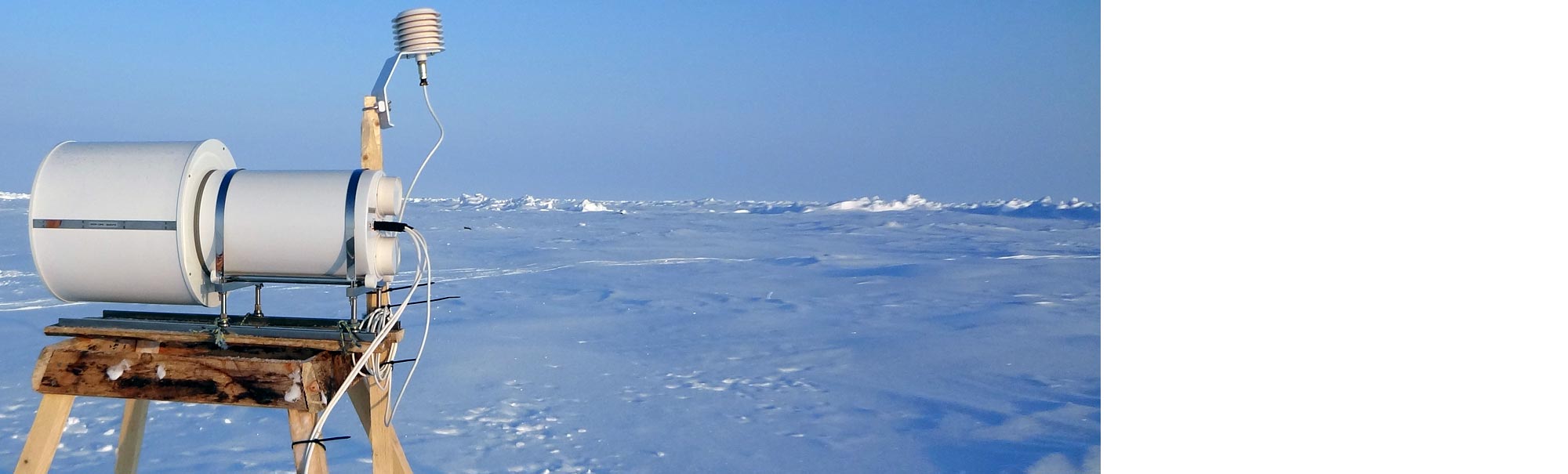
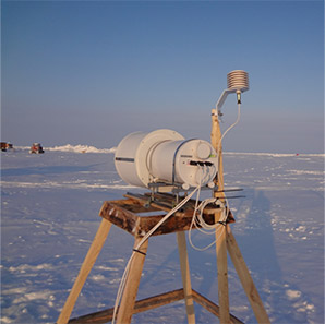
At first time the unique results about thermal regime of the polar atmospheric boundary layer (ABL) had been obtained during expedition of the Arctic and Antarctic Research Institute on the Russian drifting ice stations "North Pole - 39" and "North Pole -40" in April 2012 - June 2013. These measurements have been provided by new MTP-5 PE.
With MTP-5 PE scientists obtained continuous temperature profiles data during
14 month of the drift more than 2000 km in Canadian sector of the Arctic Basin.
Click to read our publications.
Join our communities: MWRnet and
MTP-5 Community
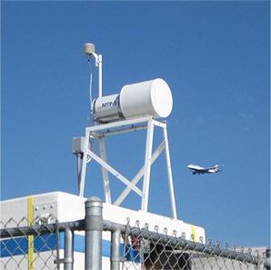
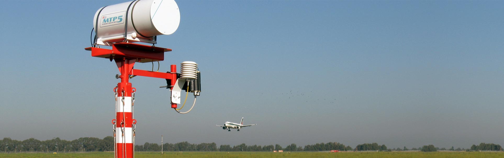
 Aviation
 Nuclear
 Meteorology
 Science
 Ecology